This article is from page 6 of the 2006-09-19 edition of The Clare People. OCR mistakes are to be expected so download the original SWF or the rendered page 6 JPG
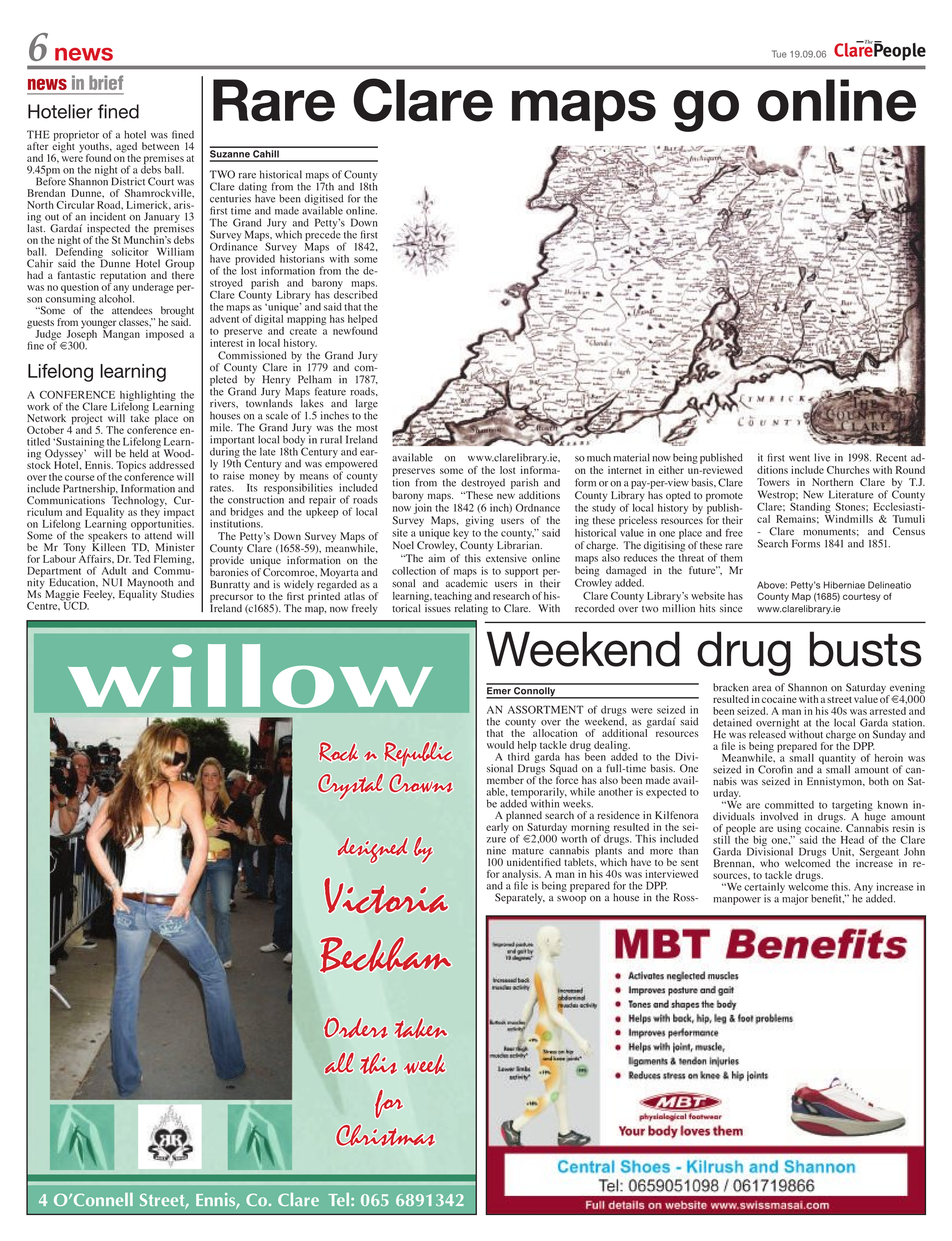
TWO rare historical maps of County Clare dating from the 17th and 18th centuries have been digitised for the first time and made available online. The Grand Jury and Petty’s Down Survey Maps, which precede the first Ordinance Survey Maps of 1842, have provided historians with some of the lost information from the destroyed parish and barony maps. Clare County Library has described the maps as ‘unique’ and said that the advent of digital mapping has helped to preserve and create a newfound interest in local history.
Commissioned by the Grand Jury of County Clare in 1779 and completed by Henry Pelham in 1787, the Grand Jury Maps feature roads, rivers, townlands lakes and large houses on a scale of 1.5 inches to the mile. The Grand Jury was the most important local body in rural Ireland during the late 18th Century and early 19th Century and was empowered to raise money by means of county rates. Its responsibilities included the construction and repair of roads and bridges and the upkeep of local institutions.
The Petty’s Down Survey Maps of County Clare (1658-59), meanwhile, provide unique information on the baronies of Corcomroe, Moyarta and Bunratty and is widely regarded as a precursor to the first printed atlas of Ireland (c1685). The map, now freely available on www.clarelibrary.ie, preserves some of the lost information from the destroyed parish and barony maps. “These new additions now join the 1842 (6 inch) Ordnance Survey Maps, giving users of the site a unique key to the county,” said Noel Crowley, County Librarian.
“The aim of this extensive online collection of maps is to support personal and academic users in their learning, teaching and research of historical issues relating to Clare. With so much material now being published on the internet in either un-reviewed form or on a pay-per-view basis, Clare County Library has opted to promote the study of local history by publishing these priceless resources for their historical value in one place and free of charge. The digitising of these rare maps also reduces the threat of them being damaged in the future”, Mr Crowley added.
Clare County Library’s website has recorded over two million hits since it first went live in 1998. Recent additions include Churches with Round Towers in Northern Clare by T.J. Westrop; New Literature of County Clare; Standing Stones; Ecclesiastical Remains; Windmills & Tumuli – Clare monuments; and Census Search Forms 1841 and 1851.